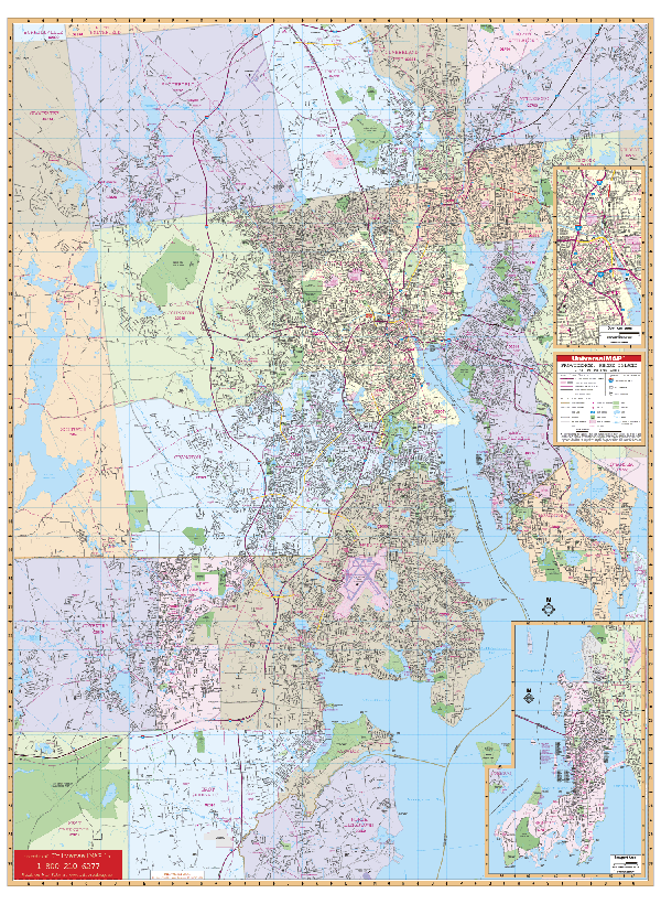
The Providence, Rhode Island Wall Map by Kappa Map Group Measures 54? W x 73? H, has complete street detail at a scale of 1? = 1,458 feet, up-to-date cartography with new streets and changes, color, and a markable and washable laminated surface. Mounted on the top and bottom with hanging rails. Indexed in a separate book.
Includes the towns and cities of Barrington, Central Falls, Cranston, East Providence, East Greenwich, Johnston, Newport, Pawtucket, Smithfield, Warwick and West Warwick, portions of Coventry, Lincoln, North Kingstown, Cumberland, Glocester, Scituate, North Attleboro and Attleboro. Boundaries as follows: North: North Attleboro, MA; Woonsocket Reservoir in Smithfield, Exit 9 on I-295; South: North Kingstown, Quonset State airport, and east Greenwich; East: Barrington and East Providence and Pawtucket to MA State line; West: Flat River Reservoir in Coventry, RI, Scituate, and Scituate, RI. There are inset maps of Newport and downtown Providence.
The special features and data contained on this map are as follows: all streets and highways, government buildings, airports, golf courses and country clubs, railroads, longitude and latitude lines, ZIP codes and ZIP code boundaries, shopping centers, recreational parks, mileage circles, cemeteries, educational facilities, hospitals, post offices, city limits and annexations, fire and police stations, and miscellaneous points of interest.
Railed wall maps can be turned into pull down maps on spring rollers for an additional $30.
Year: 2003
Edition: 2nd
These maps are printed and finished to order. Please allow 4-6 weeks for delivery.