The Role of Maps in Scientific Research and Exploration
I have to say there is almost nothing more valuable than a map in scientific research and exploration. I mean, they show us everything from the distribution of rocks and minerals in the Earth's crust to the migration patterns of animals. Without maps, we'd be blind as bats out here trying to figure out this crazy world we live in.
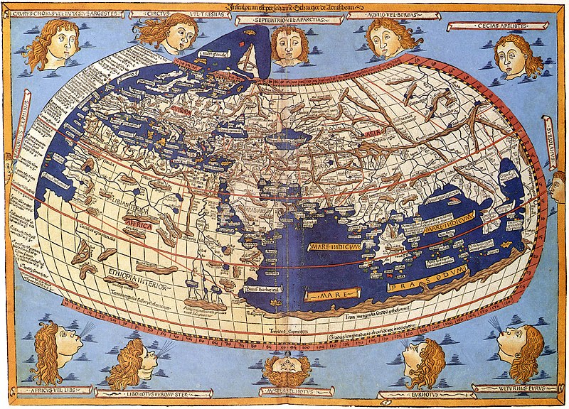
Ptolemy's world map created circa 150 was a very early example of the role maps played in the scientific and exploration research. For hundreds of years, this map was used by astronomers and navigators. It was the first map to include the concept of latitude and longitude lines. This idea of a latitude and longitude coordinate system changed the way cartographers looked at the world.
Geology is another example. Geologists use maps to study rock layers and predict where certain minerals might be found. They can even reconstruct a whole area's geological history just by analyzing those rock patterns. And let's not forget about environmental science and ecology, where maps help us track animal populations and see how our human activities affect nature.
Oceanography is also heavily reliant on maps - how else would scientists chart ocean currents or understand how climate change affects our planet's oceans? Maps of the seafloor have revealed some pretty wild stuff too, like ancient volcanic activity and underwater mountains.
Oh, but that's not all! Even space exploration wouldn't be possible without those trusty little things called maps. Mapping other planets and moons has helped us better understand their geological composition. Plus, they help plan out super important missions like sending a rover to Mars!
So yeah, long story short - if you're in the business of scientific research or exploration (or even if you just love learning about this stuff), you best believe that maps are an essential tool for uncovering new discoveries about our wicked cool universe!
At GeoMart, we offer a range of maps and related products that can aid in scientific research and exploration. Our nautical charts and maps of the seafloor are essential tools for those studying the ocean, while our raised relief maps and globes can help geologists and other scientists visualize topography and geographical features.
Whether you are a professional scientist or an amateur explorer, GeoMart has the maps and tools you need to make new discoveries and expand your knowledge. Visit us at geoMart.com to shop our selection today.