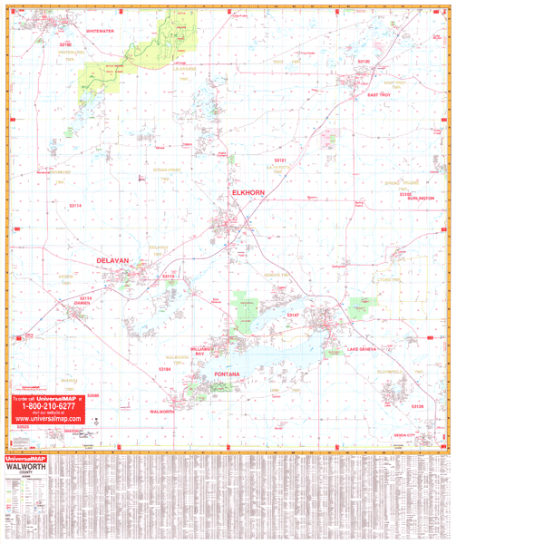
The Walworth, Wisconsin Wall Map by Kappa Map Group offers up-to-date cartography in complete street detail, is printed in color, laminated, indexed for streets on the face of the map, and measures 4 1/2 feet by 3 feet 4 inches.
Coverage ranges north to the Jefferson-Waukesha County line; south to the State line; east to the Racine-Kenosha County line; and west to the Rock County line.
Details all streets, post offices, hospitals, railroads, mileage circles, airports, cemeteries, shopping centers, water features, recreational parks, government buildings, fire/police stations, educational facilities, golf courses/country clubs, and ZIP codes/boundaries.
Framing rails are included on top and bottom for easy wall mounting. Railed wall maps can be turned into pull down maps on spring rollers for an additional $30.
Year: 2000
Edition: 1st
These maps are printed and finished to order. Please allow 4-6 weeks for delivery.