Menu


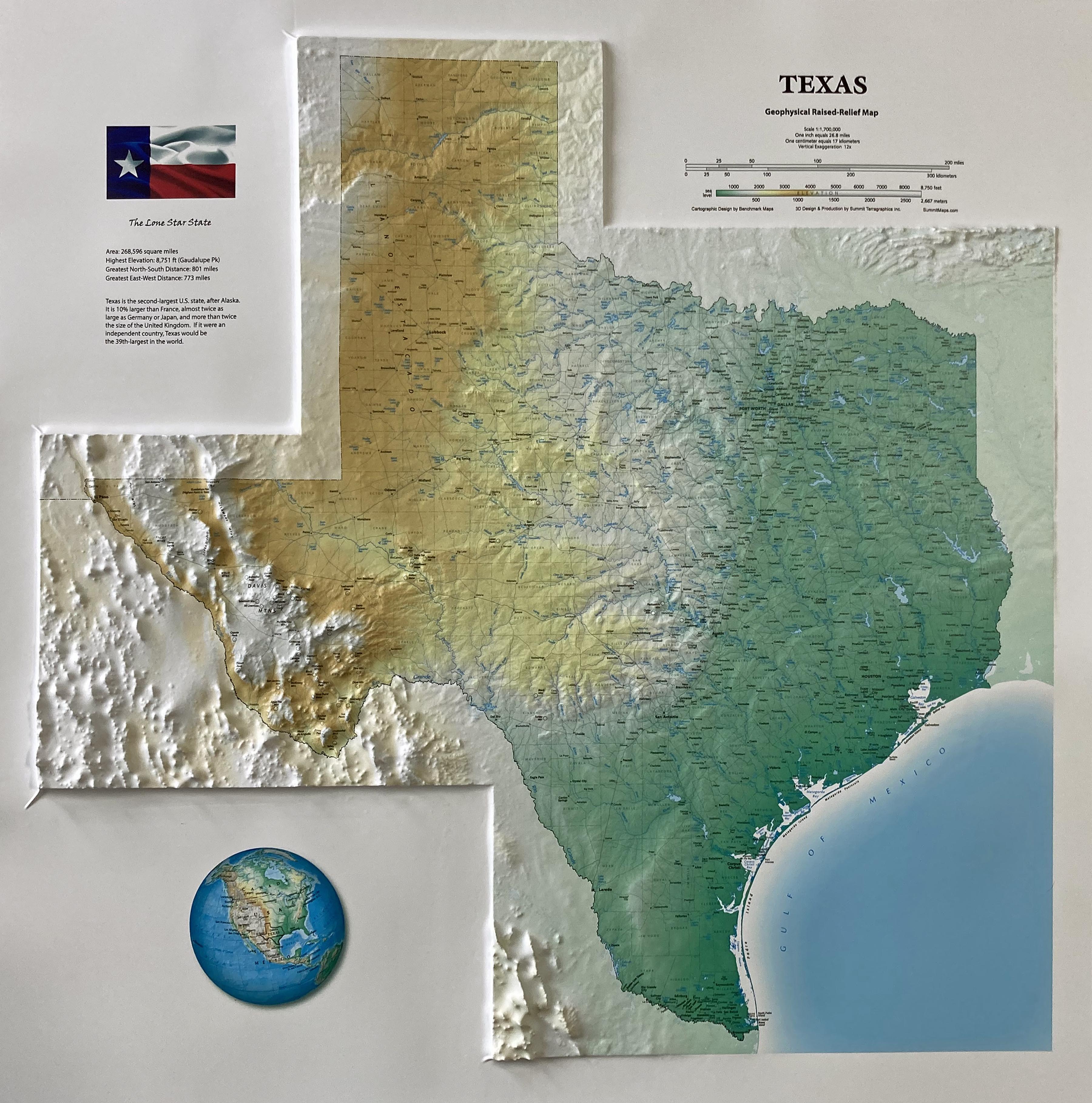
This 3D map of Texas offers an impressive and comprehensive view of the Lone Star State. It features a raised relief that is enhanced by an eye-catching elevation color-ramp base layer, giving a vivid representation of the area's topography. Various geographical landmarks, including towns, rivers, mountains, and ranges, are labeled for easy identification. The map also extends beyond Texas to include the neighboring states and Mexico.
The map is available mounted, framed in a high-quality black anodized aluminum frame, and ready to hang. Or buy it as a 3D poster, which tack to a bulletin board or mount and frame yourself.
Also available in a smaller size 22" x 22"

This large map is available fully framed and ready to hang or unframed, perfect for pinning to a bulletin board.
Usually ships in 5-7 business days. Please allow additional 5 business days for framed options.
This 3D map of Texas offers an impressive and comprehensive view of the Lone Star State. It features a raised relief that is enhanced by an eye-catching elevation color-ramp base layer, giving a vivid representation of the area's topography. Various geographical landmarks, including towns, rivers, mountains, and ranges, are labeled for easy identification. The map also extends beyond Texas to include the neighboring states and Mexico.
The map is available mounted, framed in a high-quality black anodized aluminum frame, and ready to hang. Or buy it as a 3D poster, which tack to a bulletin board or mount and frame yourself.
Also available in a smaller size 22" x 22"
This large map is available fully framed and ready to hang or unframed, perfect for pinning to a bulletin board.
Usually ships in 5-7 business days. Please allow additional 5 business days for framed options.