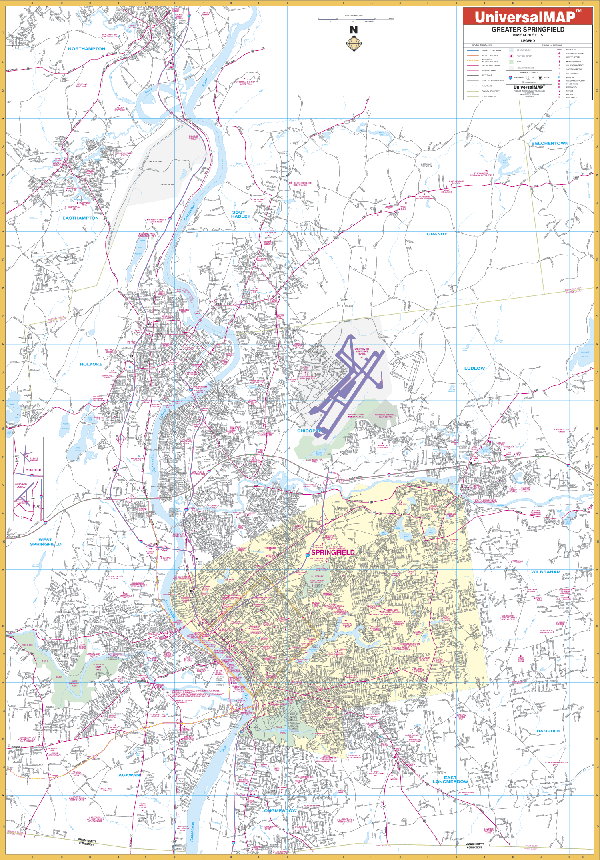
The Springfield, Massachusetts Wall Map published by Kappa Map Group measures 68? W x 50? H. Provides complete street detail at a scale of 1? = 2,640 feet with up-to-date cartography with new streets and changes. Printed in color with a markable/washable-laminated surface. Streets indexed on the face of the map. Includes hanging rails mounted top and bottom.
Area of coverage: North: to Smith College in Northhampton; South: to MA-CT line; East: to Springfield Reservoir in Ludlow; West: to Westfield State College in Westfield. insets: Downtown Springfield and Southwick.
Details include: all streets, post offices, hospitals, railroads, longitude/latitude, airports, cemeteries, shopping centers, water features, recreational parks, city limits/annexations, government buildings, fire/police stations, educational facilities, golf/country clubs, ZIP codes/boundaries, and points of interest.
Railed wall maps can be turned into pull down maps on spring rollers for an additional $30.
Year: 2002
Edition: 1st
These maps are printed and finished to order. Please allow 4-6 weeks for delivery.