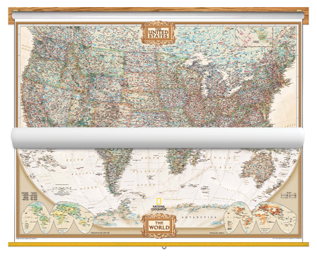
Educational and aesthetic, brighten up any classroom with this National Geographic Political US and World Map Classroom Pull Down Bundle. The World Political Map uses the Winkel Tripel projection to reduce distortion of land masses as they near the poles. Features include subtle border coloring on land, and prevailing winds and ocean currents at sea. Separate insets show the North and South Polar Regions, world vegetation and land use, and world population density. The United States Political Map uses bright color bands to outline each state. Capitals, major cities, selected towns, bodies of water, highways, and national parks are all shown. Shaded relief, rich in detail, emphasizes the many mountains, valleys, and plateaus of the USA.
Both the National Geographic Political USA & World Map are printed on 24lb. premium coated bond paper. They are also laminated on both sides using 3mm hot lamination, which protects your wall maps and allows you to write on them with dry-erase markers.
These laminated educational Pull Down maps are mounted to secure Spring Rollers ready to hang on any classroom wall.