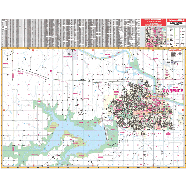
The Lawrence, Kansas Wall Map by Kappa Map Group measures 54? W x 44? H (4'6" W x 3'8" H) and shows complete street detail at a scale of 1? = 1,850 feet. Provides up-to-date cartography with new streets and changes. Printed in color with a markable and washable laminated surface. Streets are indexed on the face of the map. Framing rails are included on top and bottom for easy wall mounting.
Area of coverage: North: to North 2100 Rd., including part of Lecompton; South: to North 950 Rd., including the Rockhaven Recreation Area; East: to the Douglas-Leavenworth County line; West: 1 mile West of the Douglas-Schawnee County line. Includes inset of Downtown Lawrence.
Details provided: airports, cemeteries, hospitals, railroads, post offices, points of interest, all streets and highways, shopping centers, recreational parks, mileage circles, city limits and annexations, government buildings, fire and police stations, educational facilities, golf and country clubs, ZIP codes and boundaries, and longitude/latitude lines.
Railed wall maps can be turned into pull down maps on spring rollers for an additional $30.
Year: 2003
Edition: 2nd
These maps are printed and finished to order. Please allow 4-6 weeks for delivery.